Digitizing American Viticultural Areas
Project Overview
Appellations are used world-wide to designate agricultural products of a certain character and quality. The American Viticultural Areas (AVAs) are appellation areas within the US used to describe areas contributing to a specific territory for wine grapes. These areas are widely used in industry and research, yet available datasets are either prohibitively expensive, or lacking thorough documentation.
The UC Davis library, in conjunction with UC Santa Barbara, Virginia Tech, and contributions from the general public, are creating a publicly accessible geospatial dataset of American Viticultural Areas boundaries. The AVA Project empowers researchers to study emerging environmental questions, evaluate wine production and marketing data, compare wine aesthetics by geography, and otherwise enrich science related to different wine-growing environments.

Research Approach
AVA boundaries are established by the Alcohol and Tobacco Tax and Trade Bureau (TTB) under the Department of the Treasury. Today there are 142 AVAs in California, each recognized for its distinctive topographical, climatic, and/or historic and cultural features. Some are as well-known as the Napa Valley AVA established in 1981, or as new as the Tehachapi Mountain AVA established in 2020.
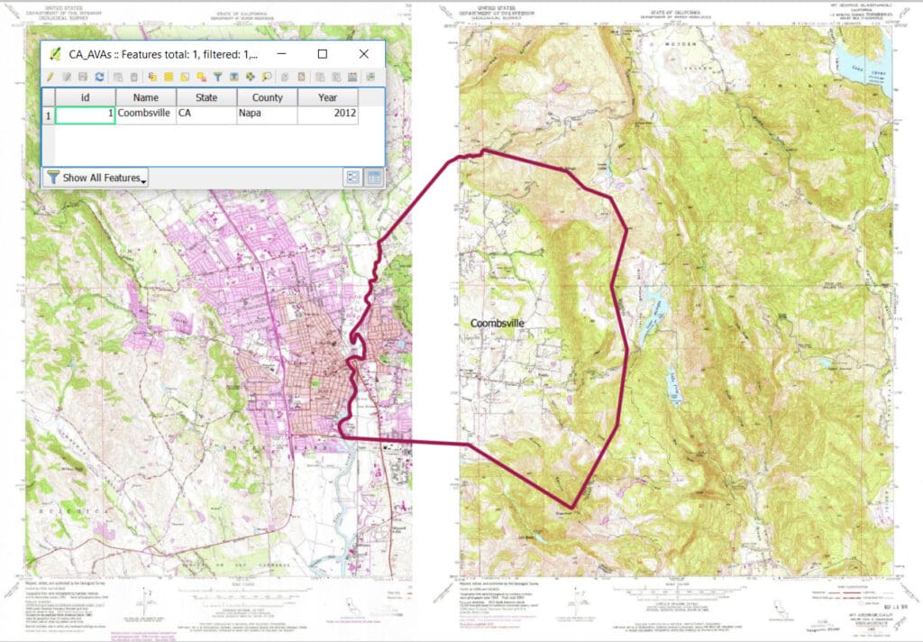
We are creating this dataset using the official descriptions in the Federal Register. The AVA dataset is freely available for anyone to use. By developing a cooperative project aimed at making AVAs boundaries available as an open GIS dataset, we will extend to researchers and industry a tool that allows them to better visualize, publicize, and compare their data. The AVA data has been used for academic papers, books, industry maps, and won the 2018 Larry L. Sautter Award for advancing the university’s mission of teaching, research, and public service.
Project Progress
The next step of the AVA project is digitizing the historic boundaries of the AVAs in our dataset. Adding these changes over time will allow researchers to use the boundaries as they were regardless of the time horizon of their question. It will also allow exploration of how these boundaries shift over the years, and what impact that has on wine as a product and a field of study.
- August, 2021: the project is nearing completion. All of the current and historical boundaries are digitized. California’s boundaries have been checked for quality control and we are finishing up a few remaining boundaries outside of California.
- March 20, 2020: all American Viticultural Area (AVA) boundaries in California have been added and have undergone our quality control procedure. We feel that the current data for California is of high quality and suitable for use in academic research, however, please submit an Issue if you find additional areas of concern in the dataset so we can address them.
- September 2020: all the remaining US AVA boundaries outside of California have been completed, and we are beginning quality control procedures on these data. New AVAs that were approved by the Alcohol and Tobacco Tax and Trade Bureau (TTB) between June and October 2020 are in the process of being added to our dataset.

Project Partners and Volunteers
The American Viticultural Area (AVA) project is a collaboration between UC Davis, UC Santa Barbara, Virginia Tech, and volunteers.
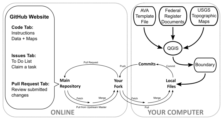
The AVA project has come this far with the help of over 20 contributors, and the team is always growing. Anyone is able and encouraged to contribute to the project by following the guidelines available on the project GitHub repository. These guides go over the process for setting up your workspace, contributing to the dataset, and helping with quality control. We invite you to check the issue board to see what areas are currently in progress. In general, AVAs are being added from West to East across the continental United States.
Team
DataLab
- Michele Tobias (technical lead)